Category: The Earth is Spherical

Showing that the Earth can not be flat.

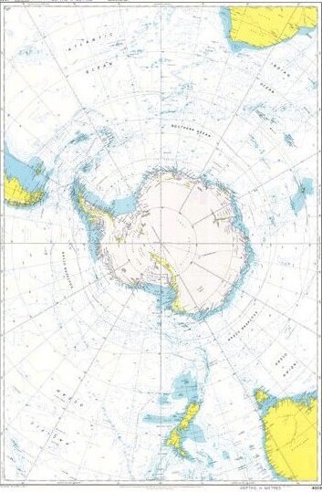
  • Admiralty Chart 4009

    All maps are flat” flerfs will say, usually to avoid showing a flat Earth map. Making a flat Earth map would be simple, using just a straight transformation of the terrain with the same scale everywhere.

    In contrast, the scale on all maps of the actual Earth varies, as every map is a projection of a globe.

    One map I’ve yet to hear a flerf comment on substantively is Admiralty Chart 4009, even though it’s the type of map flerfs should be familiar with.

    (more…)
  • Research “Fundamentals of Surveying”

    Flerf comment of the day:

    All elevations and elevation angles are measured from and use a horizontal, straight reference plane. You can research “Fundamentals of Surveying”.

    OK.

    S.K. Roy: Fundamentals of Surveying. Second Edition 2010.

    (more…)
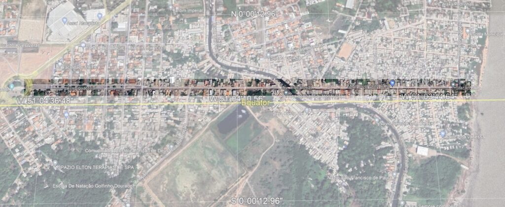
  • Avenue Equatorial

    Google Earth image of Avenue Equatorial in Macapá, Brazil
    Avenue Equatorial. Credit: Google Earth.

    The Avenue Equatorial runs along the equator in Macapá, Brazil. We can use it to test ideas about the shape of the Earth. Anyone with access to Google Maps or similar navigational tools can verify this for themselves.

    (more…)
  • Converging Lines of Longitude

    The Earth is a sphere, as confirmed by measurements of its surface. For centuries, its features have been mapped using the spherical coordinate system of latitude and longitude. The convergence of lines of longitude at the poles, instead of running parallel everywhere, clearly shows that the Earth is not flat.

    The following is an AI generated explanation of how meridians map to the surface of the Earth, showing it is spherical and kicking off this website.

    (more…)