
The Greek astronomer Hipparchus is credited with specifying locations on the Earth using latitude and longitude in the 2nd century BC. It wasn’t until the 18th century AD that John Harrison produced the first timepiece good enough to enable marine navigators to get an accurate fix on their longitude.
It’s safe to say that flat earthers and the rest of civilisation agree that the latitude/longitude coordinate system accurately maps locations on the Earth; after all, they make a lot of noise about celestial navigation proving the Earth is flat.
So, can latitude and longitude be used to find out what shape the Earth is?
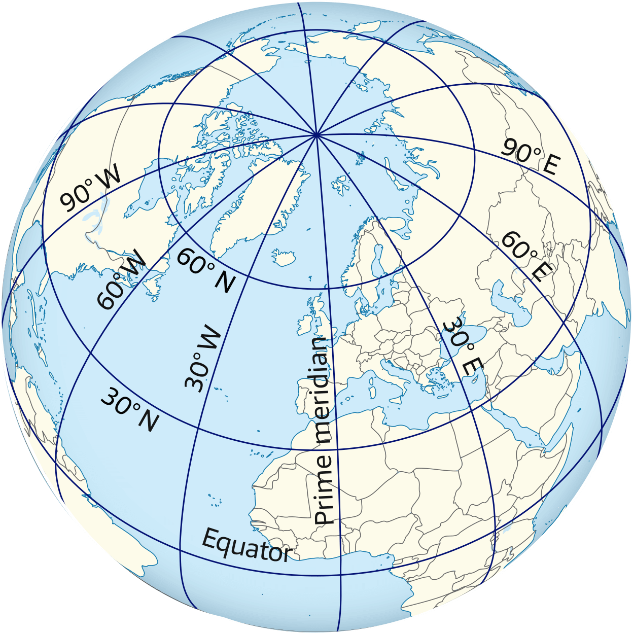
On the globe, meridians (lines of longitude) diverge from the NP, are furthest apart when they cross the equator, then converge to meet again at the South Pole.
Some spherical geometry is required to figure out the distances between them.
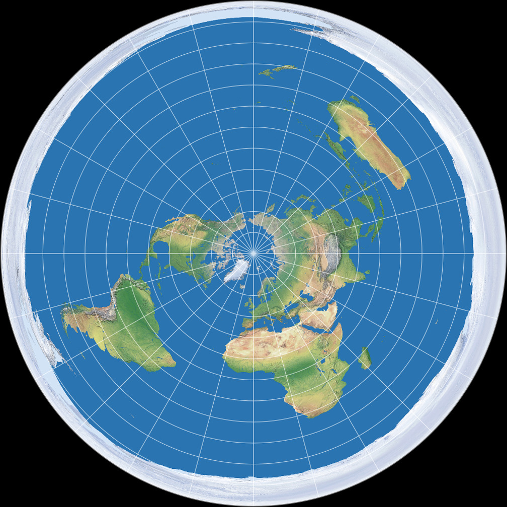
On a flat earth, meridians still radiate from the NP. However, they continue like this past the equator. Distances between them continue to increase until whatever Flerfs think the edge of their flat plain is.
We need planar geometry to get the distances between them.
This is similar to the argument in Avenue Equatorial. There we used the distinct geometries of globe and flat Earth to determine which model accurately predicted the length of a road running along the equator. Now we’ll compare the Avenue Equatorial with roads at other latitudes.
| Location | Avenue Equatorial, Macapa, Brazil |
| Latitude (deg) | 0.0 |
| Long. (start) | 51.0759 W |
| Long. (end) | 51.0670 W |
| Difference in longitude (deg) | 0.0089 |
| Location | Avenue Ipiranga, Porto Alegra, Brazil |
| Latitude (deg) | 30.1 S |
| Long. (start) | 51.1699 W |
| Long. (end) | 51.1594 W |
| Difference in longitude (deg) | 0.0105 |
| Location | RN3, Tierra del Fuego, Argentina |
| Latitude (deg) | 54.6 S |
| Long. (start, deg) | 67.4829 W |
| Long. (end, deg) | 67. 4669 W |
| Difference in longitude (deg) | 0.0160 |
| Location | Flat | Globe | Actual |
| Av. Equatorial | 0.99 | 1.00 | |
| Av. Ipiranga | 0.0105 | ||
| RN3 | 0.0160 |
To summarise, using Google Earth, a 30” (30 arc second) span of the Avenue Equatorial in Macapá, Brazil measures 1,145 metres. This road, as the name suggests, runs along the equator.
Further south in Brazil on roughly the same longitude is the Avenue Ipiranga in Porto Alegre. This road runs almost parallel with Avenue Equatorial at latitude 30° 03’ 22”. A 37” span of this road measures 989 m.
So yes, lines of longitude converge south of the equator.
Leave a Reply