Flerfs have a hard time finding any sources that support their claims. This leads to ‘cherry picking’ sections of text from other sources; without fail they remove context and misrepresent the authors of these sources. See also Toon’s law of Flerf #1 .
One of the stranger cherry picks is this, from the University of Hawaii, used by “Mr Ghetto Daddy” on YouTube.
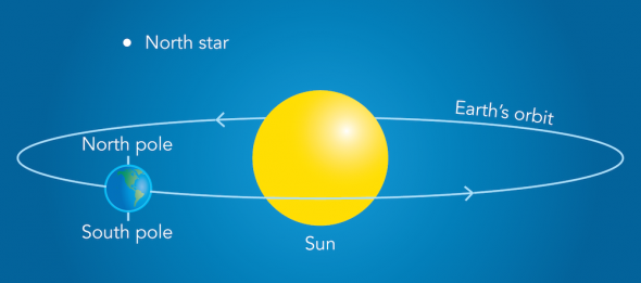
If you can locate the North Star, the angle between the height of the North Star when it reaches its zenith (highest point) in the sky and the horizon indicates your location in degrees latitude1. The North Star is a unique star for navigation in the northern hemisphere because it is located almost directly above the earth’s North Pole (SF Fig. 8.3). At the equator, an observer will see that the North Star is located almost exactly at the horizon. Thus, at the equator, the angle between the horizon and the North Star is zero degrees, indicating the observer is at zero degrees latitude.
Hard to know were Mr Ghetto Daddy is going with this. The reference to ‘hemisphere’ is ignored, and the reference to Fig 8.3 is removed from his quote. Here is that diagram. Note the rather large distance to Polaris. No wonder as to why he removed the reference.
SF Fig. 8.3. A diagram depicts the relationship between the North Star, Earth’s axis, and its orbit (diagram is not drawn to scale). The North Star is 434 light-years away from earth.
His ‘point’ seems to be that because Polaris (the North Star) is on the horizon for an observer at the equator, then the Earth must be flat. Well if the Earth was flat and celestial objects such as Polaris are some height above it, it could never be on the horizon; it would always be at a positive altitude angle above it. We can work this out by adding the end of the quote, which Ghetto Daddy omitted.
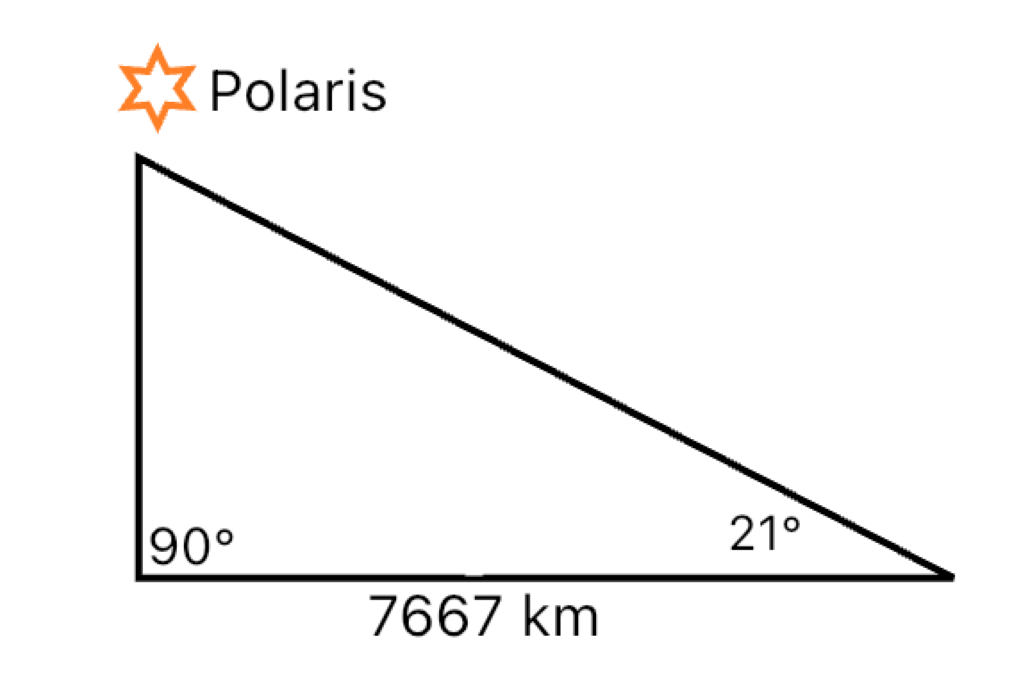
If an observer is standing on the island of O‘ahu, Hawai‘i, the angle between the horizon and the North Star is approximately 21 degrees, indicating the that O‘ahu is located at 21 degrees North latitude.
At a latitude of 21° North, an observer is 69° from the North Pole, the approximate geographic position of Polaris. This puts them 69 x 60, or 4,140 nautical miles (NM), or 7,667 km from the North Pole2 . On a flat Earth, we now have a right angled triangle with one side 7667 km, one angle 21°, with the right angle below Polaris.
If the Earth were flat, we could easily find the height of Polaris above the ground using simple trigonometry.
Using simple trigonometry (or easier still, an online triangle calculator), we get the height of Polaris above the ground as 2,943 km.
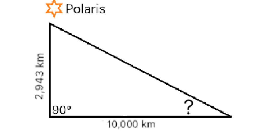
What should the altitude angle of Polaris be for an observer on the equator, assuming that our calculation is correct and Polaris is 2,943 km above the Earth (assuming flat earth remember). Armed with our height of Polaris, we can move back to the equator, 0° latitude. This is 90 x 60, or 5,400 NM/10,000 km.
Having determined the height of Polaris to be 2,943 km above the ground, what should it’s elevation angle be on the equator?
Using the triangle calculator again, with 10,000 km as our ground length and 2,943 km as the height, the altitude angle should be just over 16°; not 0° on the horizon.
Clearly the geometry demanded by a flat earth does not work. Celestial objects pinned to a fantasy dome above the earth could never touch or go below the horizon. However, it works perfectly on a globe with celestial objects being several orders of magnitude further away than suggested by flat earth.
Mr Ghetto Daddy could do far worse than enrol to study at the University of Hawaii.
More from the University of Hawaii
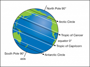
The positions of these circles [Arctic and Antarctic circles, the equator, and the tropics of Capricorn and Cancer] depend on the tilt of the earth’s axis in relation to its orbit around the sun. Today, the earth is titled at approximately a 23.4° angle, which is called its axial tilt. However, the angle of the axial tilt is not fixed; the axial tilt varies based on a number of complex cycles. The axial tilt of the earth is currently decreasing at a very slow rate. As the axial tilt decreases, the positions of the polar and tropical circles shift. This means that the polar circles are slowly migrating towards the poles and the tropic lines are slowly migrating towards the Equator.
SF Fig. 1.9. Polar circles and tropical circles are shown in black lines ending in arrows. The equator, 30° N, 30° S, 60° N and 60° S latitude are all shown in white.
The good people at the University of Hawaii know that the Earth is spheroidal. That won’t stop Flerfs hunting for and taking quotes out of context in an attempt to show otherwise.
The zenith is the point in the sky directly above an observer. The highest point a celestial object appears at an observers location is the upper culmination. At this point there will be an error of about +0.75° in the measured latitude; Polaris is not directly above the North Pole. ↩︎
The formula 60 NM per degree is used to calculate distances along great circles of the Earth, which includes lines of longitude and the equator. ↩︎
Leave a Reply